Farhan Qureshi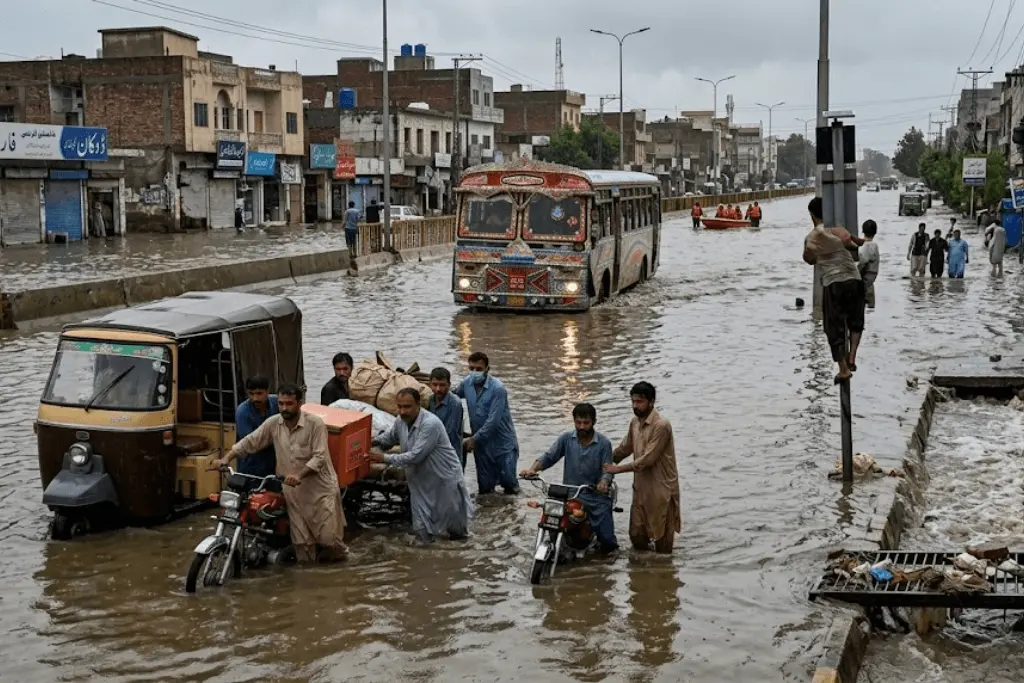
The Heavy monsoon rains across Islamabad and Rawalpindi have once again brought to light the vulnerability of Pakistan urban flooding in fast-growing urban centres to intense weather events. Water levels in Nullah Lai and other channels are above danger levels, while low-lying localities have been inundated, severely disrupting transport, damaging property and putting pressure on emergency services.
Flooding In Twin Cities Highlights Pakistan’s Urban Planning Challenge
Another bout of heavy urban flooding has struck Islamabad and Rawalpindi following torrential monsoon rain. During the heavy rains, the water level in Nullah Lai, one of the major drainage systems of the Rawalpindi region, has been observed to be as high as 10.5 to 11 feet, posing major threats to the low-lying areas adjacent to it.
The flooding shows how urban drainage systems can be overwhelmed by large amounts of rain in a short space of time. Accumulation of water can impact roads, residential areas and major transport routes before municipal agencies can respond.
https://www.instagram.com/reel/DcLWhDGDpSn
Urban Flooding Gets Worse As Monsoon Rains Pour Down
Pakistan’s monsoon system is increasingly problematic for cities as rainfall can come in highly concentrated bursts. A lot of rain in a short period of time can overwhelm drainage systems built on the assumption of older rainfall patterns.
Scientific assessments have linked the rise in intensity of extreme rainfall in Pakistan to climate change. Findings like these are making climate adaptation a more important part of urban development and not just a matter for environmental policy.
Nullah Lai Still Holds The Key To Flood Management
Nullah Lai is a major outlet for stormwater in Rawalpindi and surrounding areas. Its condition and capacity are thus closely related to the safety of communities located near the watercourse.
If heavy rain causes the water level to rise quickly, the channel can be dangerous. The risk increases in communities bordering the nullah, especially in areas where construction and urban development have diminished the natural absorption of floodwater.
Fast-Growing Cities Result In More Surface Runoff
During urban growth, large areas of roads, buildings, parking areas and other hard surfaces have been developed in Islamabad and Rawalpindi. Concrete and asphalt disrupt the natural ability of soil to absorb rainfall.
During heavy rain, water therefore quickly runs off paved areas and into drainage systems in large volumes. When drainage capacity is exceeded, water collects on roads and flows into lower residential areas. When buildings or other infrastructure fill floodplains and drainage corridors, water doesn’t have the space it needs to move safely during extreme rainfall.
This problem is exacerbated in cases of urban expansion without adequate enforcement of zoning rules. Repeated flooding jeopardises developments constructed too close to natural waterways and also impedes the movement of stormwater.
Clogged Storm Drains Add To Water-Logging
Storm drains are another important part of urban flood management. Blocked drainage channels, with solid waste, sediment and other debris, can cause heavy but manageable rainfall to result in significant localised waterlogging.
So regular maintenance can make a huge difference. Drain cleaning, waste management and inspection programs can help existing infrastructure operate closer to its intended capacity when heavy rain arrives.
Pakistan Needs Proactive Flood Planning, Not Reaction
Emergency declarations remain necessary where communities are threatened by severe flooding, but the repeated invocation of the emergency machinery reveals the limits of a reactive approach. Flood resilience planning needs to be done before the extreme rainfall event occurs.
Historical flood maps, rainfall forecasts and water level monitoring can help authorities to identify areas most likely to be inundated. This kind of information can help guide infrastructure investment and emergency preparedness.
Digital Mapping Can Help To Improve Flood Preparedness
Pakistani cities can be better equipped with modern technology to understand flood risk. Digital mapping, geographic information systems and real-time hydrological models can help authorities pinpoint areas where water might pool.
Digital twin technology could help urban planners to model rainfall events before making large infrastructure decisions. Different drainage designs could be tested in digital models to see how they would cope with different intensities of rainfall.
Better Zoning Can Reduce Future Flood Exposure
One of the most important tools available to reduce long-term flood risk is urban zoning. Development rules can prohibit construction in high-risk floodplains and protect areas needed for natural water storage.
If unauthorised development continues, the regulations are of little value, and so strict enforcement is essential. Historical weather-based infrastructure standards may not provide enough protection in light of changing rainfall patterns.
Planning authorities can use updated climate projections to design drainage systems and to estimate the capacity required for major urban infrastructure. Rainwater management can also have stronger requirements in the building standards.
Flood Protection Can Help Protect Pakistan’s Economy And Communities
Urban flooding causes major economic disruption. Roads can become difficult to use, businesses may close temporarily, homes can be damaged by water, and essential services may be disrupted.
Major routes like Murree Road are especially important because any breakdown on these roads can affect a large number of commuters and commercial activities. Flooding along transport corridors can thus have implications beyond the neighbourhoods directly affected by the water.
Resilient Urban Planning: Islamabad, Rawalpindi Can Lead
The twin cities are facing serious flood challenges, but it is an opportunity for Pakistan to show stronger urban resilience. Islamabad and Rawalpindi are among the country’s most important administrative, commercial and residential hubs.
Rainfall and drainage systems do not respect municipal boundaries, and the two cities could benefit from coordinated planning to improve flood management. Water flowing through one location can pose risks elsewhere, so regional coordination is critical.
Pakistan Can Transition From Emergency Response To Resilience
Recent flooding in Islamabad and Rawalpindi underscores the need to strengthen Pakistan’s urban flood management strategy. Emergency agencies will always have a vital role to play in protecting communities during extreme rainfall events, but the longer-term resilience of communities requires investment before disasters strike.
Better drainage capacity, protected waterways, strict zoning and improved waste management can solve some of the structural causes of urban flooding. Green infrastructure and emerging digital instruments can provide additional layers of protection.
Design sensitive to climate is just as important. We are seeing changes in the intensity of rainfall, and urban infrastructure must be able to cope with conditions that may lie outside of historical norms.